Airline removes inaccurate map post after backlash over Jammu & Kashmir depiction
Nepal Airlines issued a public apology on Thursday after facing strong backlash for sharing an inaccurate map of India on social media that showed Jammu & Kashmir as part of Pakistan, triggering outrage among Indian users online.
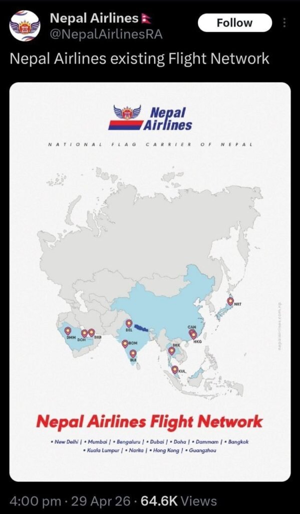
The controversy began when the airline posted a route network map on X, which social media users quickly flagged for “significant cartographic inaccuracies.” As criticism mounted, Nepal Airlines removed the post and admitted that the map “contained significant cartographic inaccuracies regarding international boundaries that do not reflect the official stance of Nepal or Nepal Airlines,” while apologising for the error in the map recently shared on its social media channels.
Airline says internal review has been launched
In its clarification, the airline said it had “immediately removed the post” and was “conducting an internal review to ensure our materials meet the highest standards of accuracy.” The company also stated that it deeply values its strong ties with neighbouring countries and regretted any offence the inaccurate post may have caused.
The apology came after several users condemned the airline’s action, with Bhojpuri actor Khesari Lal Yadav publicly criticising the post and questioning the intent behind the depiction. He wrote on X, asking, “Can anyone explain what Nepal Airlines was thinking when it tampered with India’s map, especially regarding Jammu & Kashmir?” He further said the issue was “not a minor issue” and that “it seems like a deliberate act,” calling the map error an act of “provocation.”
Khesari Lal Yadav reacts after apology
After the airline issued its statement, Khesari Lal Yadav responded in Hindi, saying that while “the English was too complicated to understand,” it appeared that an apology had been made.
The incident has drawn attention to the diplomatic sensitivity surrounding the depiction of India’s territorial boundaries, especially in relation to Jammu & Kashmir, where even minor cartographic errors can trigger significant public and political reactions.
